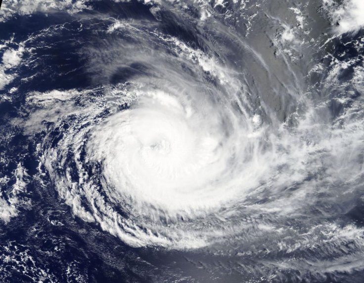
The developing Tropical Cyclone Cebile into a major hurricane in the Southern Indian Ocean was captured by NASA's Aqua satellite which passed it overhead.
On Friday, Feb. 2, the Moderate Resolution Imaging Spectroradiometer (MODIS) instrument aboard NASA's Aqua satellite captured the image of Cebile with its rounded appearance and visible eye.
As of Feb. 2 at 10 a.m. EST, Cebile's maximum sustained winds were estimated at 110 knots (126.6 mph/203.7 kph), making it a category three hurricane on the Saffir-Simpson hurricane wind scale. It had already weakened compared to a day earlier on Feb.1 at 10 a.m. EST when its maximum sustained winds were 132 mph (115 knots/213 kph), centered near 16. 1 degrees south latitude and 76.1 degrees east longitude, which is about 569 nautical miles south-southeast of Diego Garcia.
Cebile's center was located near 17.6 degrees south latitude and 75.8 degrees east longitude, about 659 nautical miles south-southeast of Diego Garcia, said a NASA statement. Cyclone Cebile was moving to the south-southeast at 6 knots (6.9 mph/11.1 kph).
However, Cebile is moving south and is forecast to continue weakening, according to the Joint Typhoon Warning Center. It said the storm to turn to the southeast and weaken more rapidly under increasingly adverse conditions and did not issue any alert for now.
Originally, on Feb. 1 at 3:36 a.m. EST (0836 UTC) the Visible Infrared Imaging Radiometer Suite (VIIRS) instrument aboard NASA-NOAA's Suomi NPP satellite captured the image of a well-rounded circulation center with bands of powerful thunderstorms wrapping into the 18 nautical-mile-wide eye, said NASA-NOAA statement. Cebile was found moving to the south-southwest at 5.7 mph (5 knots/9.2 kph).
The Joint Typhoon Warning Center noted "there appears to be a wobbling motion in the eye feature as the system attempts to make a poleward (southerly) turn. The initial position is based on a microwave eye feature in (an AMSU-b instrument image from Feb. 1 at 7:08 a.m. EST/1108 UTC) pass with low confidence due to erratic motion and the likely tilted vertical structure of the system."
Cebile was expected to encounter cooler sea surface temperatures and increasing vertical wind shear on its second day and in five days it is expected to transition to an extra-tropical storm.


