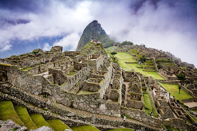
A team of researchers have discovered a fascinating ancient settlement in the Peruvian Andes that pre-dates the famous Inca site of Machu Picchu, which was built in the 15th century. To conduct this exploration project researchers used a technology called light detection and ranging, commonly known as LiDAR. This newly found city was settled by the Incas and the people who came before them, pre-Incas.
As per National Geographic explorer Albert Lin and two other archaeologists Adan Choqque Arce and Thomas Hardy, this ancient Inca settlement lies in an archaeological zone known as Wat'a, which means "island" in the local Indigenous language. It should be noted that this city is located at an altitude of around 13,000 feet, which means the Inca settlement is almost 5,000 feet higher than Machu Picchu. The historians claim that the Inca civilization flourished in ancient Peru between c. 1400 and 1533 CE and extended across western South America from Quito in the north to Santiago in the south.
The archaeologists first used traditional methods to explore the city and found evidence of tombs, ceremonial plazas, residential areas as well as a large surrounding wall. Later, with the help of LiDAR, they uncovered many previously unknown features. It should be mentioned that this new technology was used by the researchers at the University of Witwatersrand who unearthed a lost city in South Africa that is known as Kweneng.
As reported by Newsweek, Lin stated that "You're at around 13,000 feet of elevation and its mostly open landscape because there's not a lot of trees around, so you're basically baking in the high altitude sun, all the way up."
In addition he said after getting up there "You have these grand vistas—all the surrounding mountains that are really gorgeous—and the site itself, which sits above that mountain, is a perfect viewpoint down to all the different valleys that are coming up as a trade route, maybe possibly even towards the site that would one day become Machu Picchu."
By using this laser technology the archaeologists received an opportunity to see what was hidden under the thick shrubs and countless cacti in the mountain. The data collected by the instrument then transformed into 3D maps that reveal the topography of the land and underground ancient man-made features. During this exploration program, the researchers identified signature Inca terracing and some circular structures associated with the pre-Incas.
It should be mentioned that like at other sites in Peru this particular archaeological site was built on top of an earlier pre-Inca settlement. Researchers involved in this excavation project stated that the site looks like a template for Machu Picchu that was constructed in the mid-15th century.


