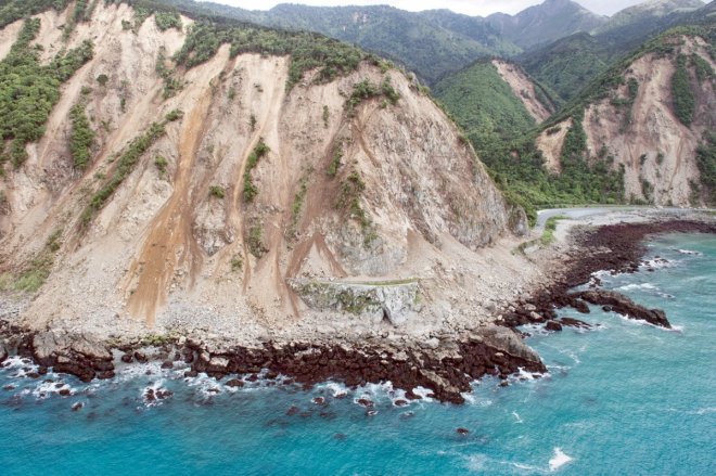
A powerful aftershock measuring 6.3-magnitude shook New Zealand's South Island on Monday, hours after a 7.5-magnitude quake hit the same area after midnight killing two people.
Reports said the new tremor hit around 1.45 pm local time (00:45 GMT) at a depth of 10km (6 miles), northeast of Christchurch on South Island.
There have been multiple strong aftershocks following the midnight quake but this was the most powerful one.
The 7.5-magnitude quake struck 16 km underground near Hanmer Springs and was felt across the country. The quake was of a greater magnitude than the devastating tremors that hit Christchurch in 2010 and 2011.
The first quake triggered tsunami warnings and destroyed buildings and roads. Power lines and telecommunication services were down in several parts of the country.
However, the tsunami alert was later downgraded, but the authorities have urged people to stay away from water bodies.
The New Zealand Herald reported that small towns on the South Island, including Kaikoura, were left isolated due to damages caused by the first quake. According to BBC, many people were being airlifted from several areas and moved to safer places.
In response to the chaos caused by the quakes, Prime Minister John Key said: "It was the most significant shock I can remember in Wellington. There will be quite major costs around roads and infrastructure."
The Civil Defence of New Zealand announced a state of emergency for the Kaikoura region shortly after the first quake.
New Zealand sits on the highly seismically active zone "Pacific Ring of Fire" and experiences frequent volcanic eruptions and earthquakes.


