A strong 6.0 magnitude earthquake struck the center of Mindanao island in the southern Philippines early on Wednesday, damaging dozens of houses and sending people fleeing into the streets for safety, the US Geological Survey (USGS) said.
The Philippine Institute of Volcanology and Seismology (Phivolcs) said the quake that hit at 5:21 am (Singapore time), had its epicenter located around 6 kilometers southwest of Wao, Lanao del Sur, a mainly rural region some 800 kilometres (500 miles) south of Manila, at a depth of 1 kilometer.
The authorities said it was very shallow, at a depth of 6km, which would have amplified its effect. Initially, it was reported as magnitude 5.6 and centered near Kalilangan, Bukidnon by Phivolcs, but it was revised up a few minutes later. A magnitude 5.6 quake is considered moderate and is capable of causing considerable damage.
According to the authorities, there were no immediate reports of serious casualties but electricity was cut and water pipes ruptured in Lanao del Sur.
"Residents are really shocked with regard to the calamity that happened. So they are on standby (at) the highway," Francis Garcia, provincial disaster official, told ABS-CBN television. He added that patients were evacuated outside a district hospital as a precaution.
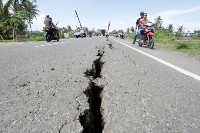
The state seismology office reported that the tremor was felt in 16 other cities and towns in the south including the major urban centres of Davao and Cagayan de Oro. It also said a highway had a crack while wooden houses, a national high school and a mosque sustained minor damage.
Francis Magbanua, an ABS-CBN reporter based in the south, tweeted a photo of a television set on the floor that he said had fallen off the wall of his house. "Our appliances fell from the (wall) racks," he posted.
Several photos that were posted on social media showed images from the site of the quake in Panang town with cracked concrete walls of houses and offices, collapsed wooden ceilings, and even fractured roads.
The earthquake came days after a trio of strong earthquakes damaged buildings and caused panicked tourists to flee Mabini, a resort town south of Manila famous for its marine life and coral reefs.
"Since the (Mabini) quake, our people became more aware to duck, (take) cover and hold," Kristofferson Vidad, science research assistant at the seismology agency, told AFP, referring to its standard advice on surviving quakes.
The Philippines sits on the highly seismically active zone "Pacific Ring of Fire" where many continental plates on the earth's crust keep colliding. Hence, it experiences frequent earthquakes.
A 6.5-magnitude quake killed eight people and left more than 250 injured outside the southern city of Surigao in February, and another 5.9-magnitude tremor killed one person there last month.
The last lethal earthquake to hit the country before the February 10 quake was a 7.1-magnitude tremor that left over 220 people dead and destroyed historic churches when it struck the central islands in October 2013.


