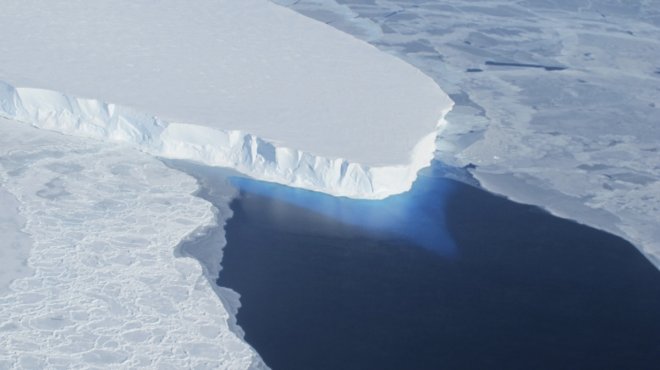
NASA has developed a predictive tool that points out which cities will be flooded when ice sheets melt. The cities that are under most danger are New York and London, as they are close to the Greenland ice sheets which have high risk of melting soon.
The technology, called Gradient Fingerprint Mapping (GFM) analyses the earth's spin and gravitational effects to determine how the water will be redistributed on the planet when ice starts melting.
Developed by NASA's Jet Propulsion Laboratory in California, the tool gives a vivid picture of how the earth may look like after global warming increases further. Titled "Should coastal planners have concern over where land ice is melting?", the study details how the melting of ice sheets will affect coastal areas, including those in England, US and Canada.
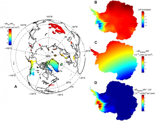
The tool works by providing "for each city, a picture of which glaciers, ice sheets, [and] ice caps are of specific importance," according to the researchers. It will help scientists figure out which body of ice to watch out for and in which places to restrict human advances.
"As cities and countries attempt to build plans to mitigate flooding, they have to be thinking about 100 years in the future and they want to assess risk in the same way that insurance companies do," says senior scientist Dr. Erik Ivins, as reported by BBC. The findings have been published in the journal Science Advances.

Places at most risk
The tool states that London could face serious issues of rising sea-level as the ice sheet in north-western Greenland melts further. Instead if the northern and eastern region melts, New York will be in serious peril.
The ice sheets in the north-northeast and north-northwest coasts of Antarctica will flood Sydney if they melt further.
Factors affecting the 'redistribution' of water
Several factors have been identified which influence how the sea levels will be affected around the world if global warming continues increasing. Two of the key factors are gravity and the earth's rotation.
"These [ice sheets] are huge masses that exert an attraction on the ocean. When the ice shrinks, that attraction diminishes-and the sea will move away from that mass," said Dr. Eric Larour, the lead scientist in this project, while explaining the effect of gravity. Due to the "push-pull influence" of ice, the group expands and compresses vertically, causing further change.
Another major factor is the earth's rotation, which affects its surface mass. "You can think of the Earth as a spinning top. As it spins it wobbles and as masses on its surface change, that wobble also changes. That, in turn, redistributes water around the Earth," says Larour.
Prediction for every city
By taking the responsible factors into account, researchers have developed a city-specific tool which can forecast how much each place on the earth is sensitive to climate change.
The study also provides exact figures and data for regions across the world.


